Details on the Fox River Trip from Monday, September 12. Raw numbers: 24.4 river miles, about 17 miles as the crow flies. It took just under eight hours, with three 20 minute breaks.
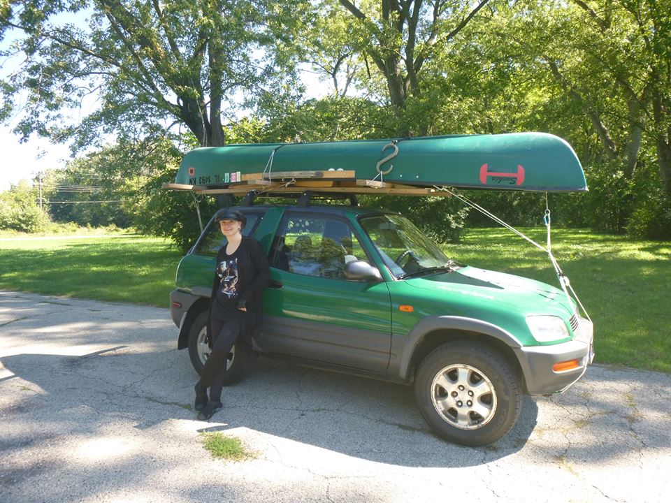
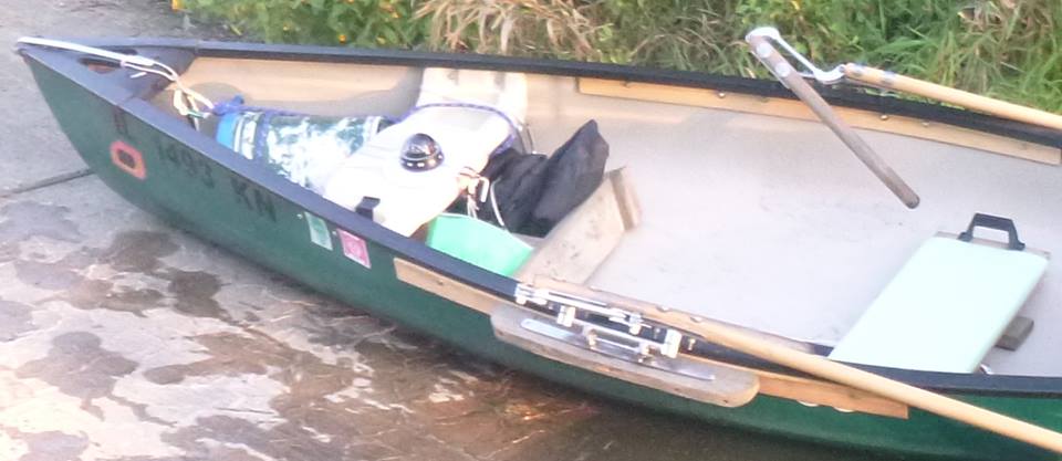
Since the river was a one way trip, Dementia and I drove to the take out point in separate cars, we left my van at there, and then proceeded to the launch point together in her car. This meant transporting the 14 foot canoe on the 11 foot Rav4. It has been demonstrated that there is no room in the interior of the Rav for two (living) people and the oars, so the oars rode INSIDE the canoe.
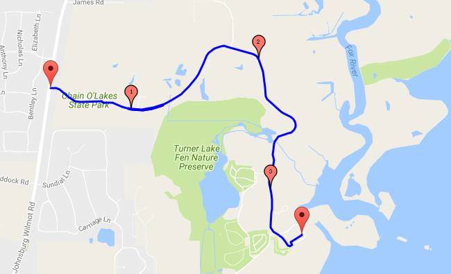
Our take out point, the boat ramp in Chain O’Lakes State Park, is at the far end of a 3.5 miles labyrinth of pretty but SLOW road. Park the van, and drive right back out again…
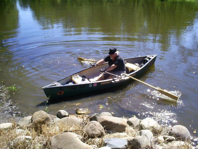
Underway, shortly after noon.
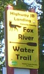
My first break was at the County Road JB mudslide, and informal boat ramp used by fisherman that was my lauch point when I did a shorter version of this trip in a much bigger boat in 2009. Since then, Kenosha County has established a “Water Trail”, which seems to consist of adding signs at existing (often marginal) access points, and adding a page to the county web site. Still, it’s positive attention to the river, and that’s a good thing.
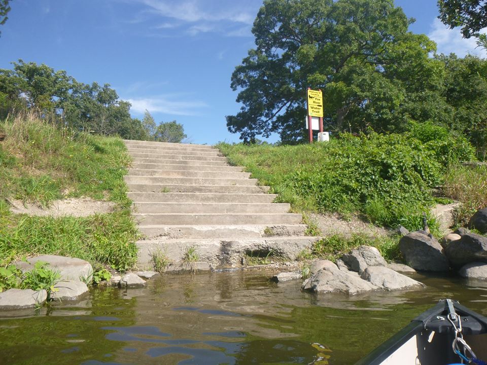
This is a launch point? Kenosha thinks so; note the “Water Trail” sign. I have my doubts.
I saw a LOT of herons on this trip, about fifty sightings overall. Though given that they usually went downstream and across the river when startled, it may have only been a dozen or so birds. Still, several of the normal blue/gray (They are “Great Blue Herons”, after all), and almost as many white ones, which Wikipedia tells me are unique to the Caribbean. No one has told the white herons this.
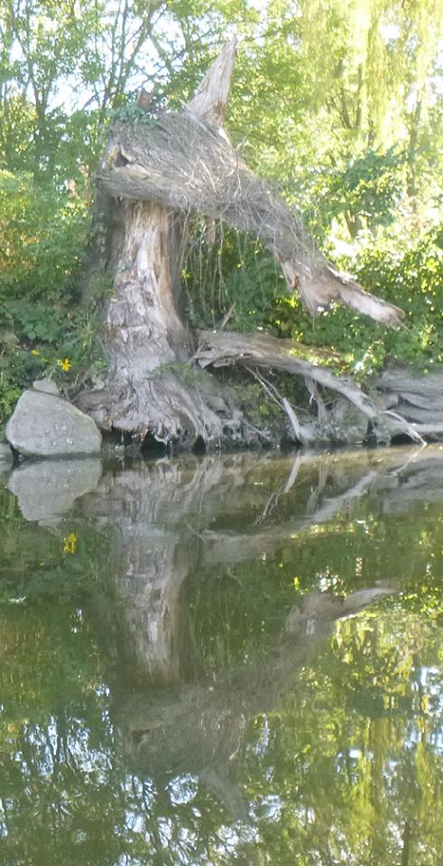
It only LOOKS like a dead tree; it’s really a troll. He looked better from further upstream, but the angle of the sun washed out every shot I tried before this one. Still, he’s cool.
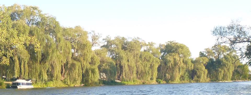
Just a string of big riverbank willows. Brother Rat MUST be around here somewhere.
Parked at Oak Point, about four miles from done. The point of this photo is the green blob above the footboard on the left; that was my text map. It was sheet of cardboard with landmarks and mileages marked in large Sharpie letters, inside a zip-lock bag. It is impossible to get LOST on this section of the Fox, and this told me where I was. I accidentally omitted one landmark (the bridge in Wilmot), and included one that has apparently disappeared since 2009: The state line signs.
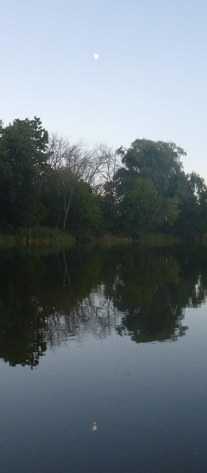
Shortly before sunset, and not a trace of civilization to be found.
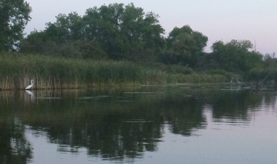
More herons, this one was taken pretty much exactly at sunset. White heron on the left, two blues on the right. Still no civilization.
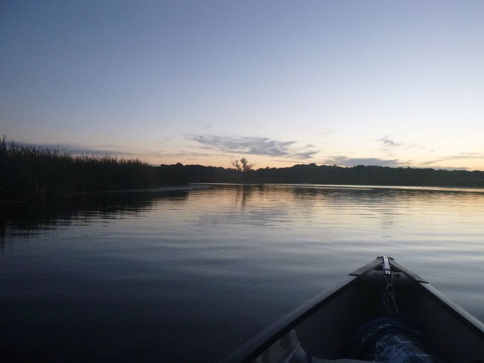
Why do I do this? Add together a sense of accomplishment, a massive dose of endorphins, and vistas like this.
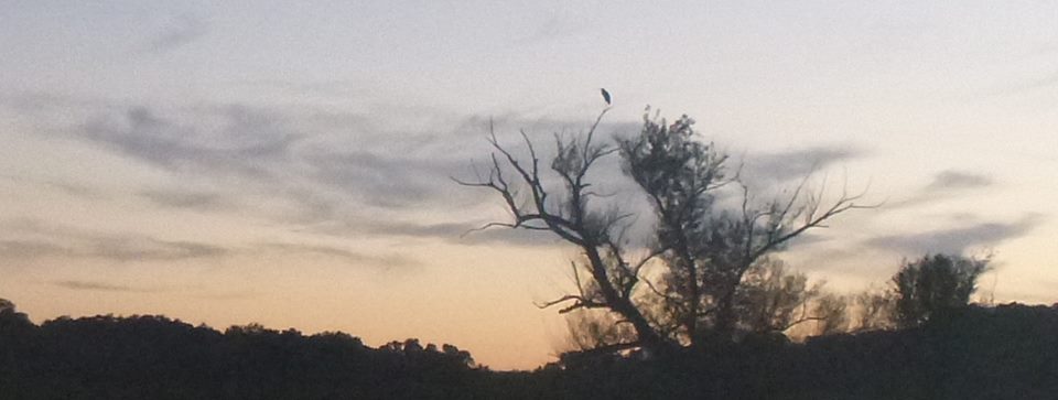
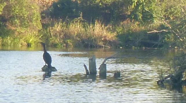
This fellow was probably already on his perch in the previous picture, but he waited for me to get close enough to really appreciate him.
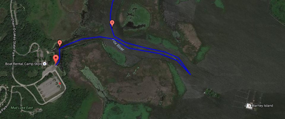
It was full dark when I saw the (meager) lights of the state park boat ramp ahead of me; I check my watch, considered my level of fatigue, and considered making the left turn and going to the end of the channel to Grass Lake first, just because “Burlington to Grass Lake” SOUNDS better. And then the river turned, and the lights at the ramp were hidden from view, and it was clear that the 3/4 mile detour was a moral imperative. I thought about lights in the distance, and sang Tolkien’s “Road Goes Ever On” as I rowed…
(The little red dot is the location of my van…)